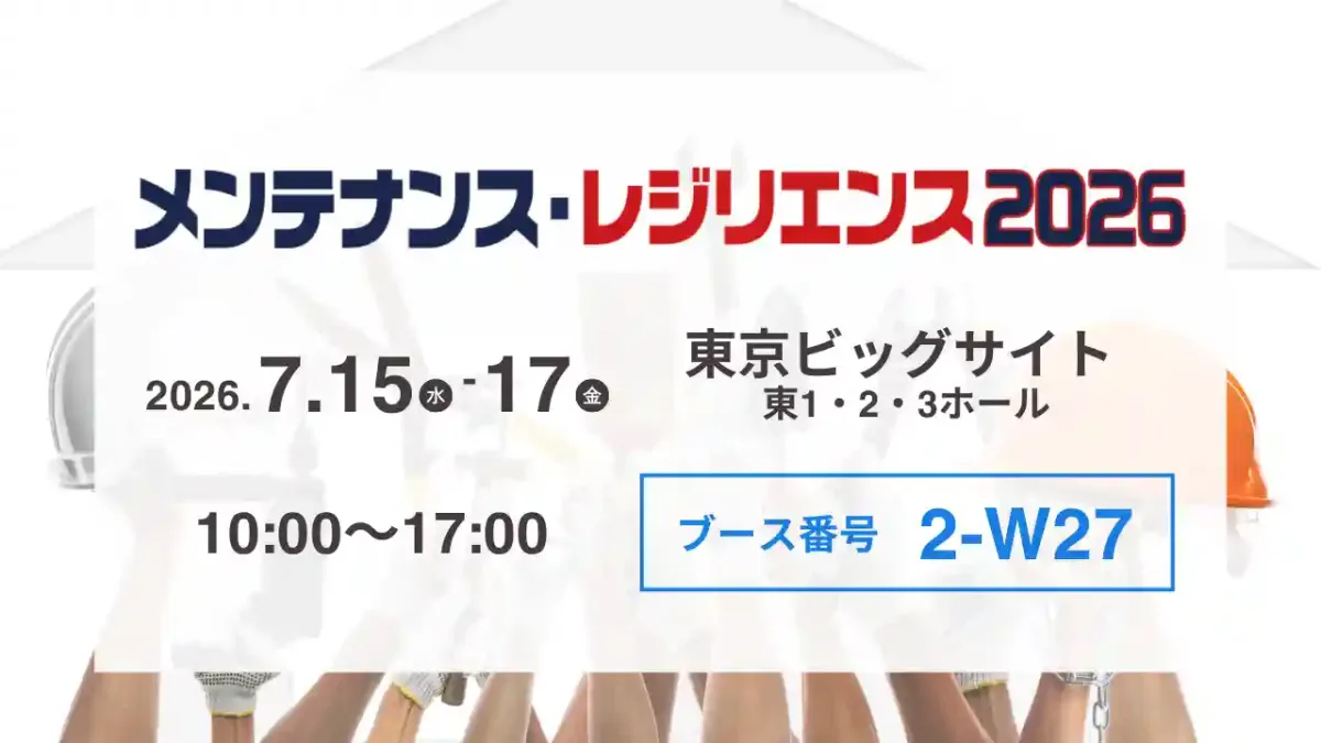
▼ Exhibition Overview
Dates and Times: July 15 (Wed) – 17 (Fri), 2026 , 10:00 a.m. – 5:00 p.m.
Venue: Tokyo Big Sight, East Hall [2-W27] (3-11-1 Ariake, Koto-ku, Tokyo)
Admission: Free (advance registration required)
We will be exhibiting at “Maintenance & Resilience TOKYO 2026,” a major trade show aimed at improving productivity in the manufacturing and construction industries and building sustainable social infrastructure, to be held at Tokyo Big Sight from Wednesday, July 15, to Friday, July 17, 2026.
This exhibition brings together the latest technologies related to the “maintenance and resilience” of social infrastructure and industrial foundations, including measures to address aging infrastructure, maintenance efficiency, disaster prevention and mitigation, and digital transformation (DX) in the construction industry.
Amid urgent needs to address labor shortages, the “2024 Problem, ” and prepare for frequent natural disasters, natCo., Ltd. proposes a solution titled “Field DX Starting with Just One iPhone, ” which dramatically streamlines infrastructure inspections and condition assessments using 3D scanning technology.
■ Highlights of the natBooth (Live Demos)
natAt our booth, we will be showcasing “ Scanat,” an app that allows you to perform high-precision 3D measurements and create models using only your everyday iPhone or iPad—without the need for expensive specialized equipment.
On the day of the event, we will be offering a “live demonstration” at our booth where you can experience scanning simulations that replicate actual structures and inspection sites.
▼ Please pay special attention to this section
・Streamlining the Maintenance and Management of Infrastructure and Structures ( Scanat-D): Instantly capture 3D models of the current condition of roads, slopes, bridges, tunnels, public facilities, and more. This helps document deterioration over time and prevents the need for repeat site visits due to missed measurements.
・Faster Disaster Recovery and Situation Assessment: Even in areas that are difficult or dangerous to access—such as those affected by landslides or structural damage—we can safely and quickly capture data on site conditions using non-contact methods.
・Faster Utilization of Drawings and BIM/CIM: By extracting DXF (CAD data) from scan data, we streamline the process of creating drawings and 3D models for older infrastructure projects or construction sites where existing drawings are unavailable.
・Seamless information sharing with remote locations: Utilize high-precision 3D models and 360-degree panoramas to visually share on-site conditions. This facilitates discussions with clients (local governments and infrastructure operators) and streamlines the process of issuing instructions to office staff.
■ Recommended for People Like This
This is especially recommended for local governments, infrastructure operators, and professionals in the architecture and civil engineering industries who face the following challenges.
⚪︎Personnel responsible for the maintenance, management, and inspection of social infrastructure and private facilities (streamlining inspections, collecting data for aging infrastructure countermeasures)
⚪︎Engineers and site supervisors in the architecture and civil engineering industries (streamlining site surveys and as-built inspections; adapting to i-Construction)
⚪︎Officials from local governments and public organizations involved in disaster response, disaster prevention, and disaster mitigation (rapid assessment of disaster damage, stockpile management, and infrastructure management)
⚪︎Surveying and Design Consultants (Speeding up as-built surveys; utilizing BIM/CIM and 3D data)
■ Venue Access Map
Venue: Tokyo Big Sight, East Hall (3-11-1 Ariake, Koto Ward, Tokyo)
Nearest Station: About a 7-minute walk from "Kokusai-Tenjijo Station" on the Rinkai Line
About a 3-minute walk from "Tokyo Big Sight Station" on the Yurikamome Line
★ natBooth Location: [2-W27]
■ Introduction to the Products on Display
3D scanning app “Scanat (Scannat)”
Defying the common belief that “expensive laser scanners are difficult to implement and operate,” this solution uses just a single iPhone—a device everyone has—to dramatically transform on-site surveys and inspection work.
With just a single, quick scan, you can take measurements within the 3D model, calculate area and volume, and export DXF files.
From large-scale civil engineering sites to infrastructure structures and complex architectural interiors, this solution eliminates the need for follow-up visits due to missed areas, significantly reducing lead times for inspection, design, and estimating tasks.
"I want to start digitizing my infrastructure and job sites in 3D right away"
"I want to immediately implement workplace reforms at job sites and advance maintenance and management practices"
We look forward to seeing you all there.